Difference between revisions of "Uvalde County"
From Texas Century Club
Dell.Little (Talk | contribs) |
Dell.Little (Talk | contribs) (→Guides and Resources) |
||
| Line 42: | Line 42: | ||
::* Seven H Ranch | ::* Seven H Ranch | ||
| + | *Dell's map of [https://www.google.com/maps/d/edit?mid=1be7-btREl74sZiPR5ivIsts864OMrus&usp=sharing| Uvalde County] for birding and exploring. It includes eBird Hotspots and additional potential locations, creek crossings and roads that may be productive. | ||
---- | ---- | ||
'''Previous county:''' ''[[Upton County|Upton]]'', '''Next:''' ''[[Val Verde County|Val Verde]]''<br/ >'''Bordering counties:''' - '''North:''' ''[[Real County|Real]]'', '''Northeast:''' ''[[Bandera County|Bandera]]'', '''East:''' ''[[Medina County|Medina]]'', '''Southeast:''' ''[[Frio County|Frio]]'', '''South:''' ''[[Zavala County|Zavala]]'', '''Southwest:''' ''[[Maverick County|Maverick]]'', '''West:''' ''[[Kinney County|Kinney]]'', '''Northwest:''' ''[[Edwards County|Edwards]]'' | '''Previous county:''' ''[[Upton County|Upton]]'', '''Next:''' ''[[Val Verde County|Val Verde]]''<br/ >'''Bordering counties:''' - '''North:''' ''[[Real County|Real]]'', '''Northeast:''' ''[[Bandera County|Bandera]]'', '''East:''' ''[[Medina County|Medina]]'', '''Southeast:''' ''[[Frio County|Frio]]'', '''South:''' ''[[Zavala County|Zavala]]'', '''Southwest:''' ''[[Maverick County|Maverick]]'', '''West:''' ''[[Kinney County|Kinney]]'', '''Northwest:''' ''[[Edwards County|Edwards]]'' | ||
Revision as of 12:25, 21 October 2024
Contents |
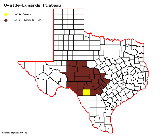
Region 5 Edwards Plateau
Previous county: Upton, Next: Val Verde, All Counties: Alphabetically
Bordering counties: - North: Real, Northeast: Bandera, East: Medina, Southeast: Frio, South: Zavala, Southwest: Maverick, West: Kinney, Northwest: Edwards
Century Clubbers
eBird Top 100
County Big Years & Big Days
eBird Hot Spots - Uvalde County
Guides and Resources
- Birdinghotspots.org - Uvalde County
- Great Texas Wildlife Trails - Heart of Texas West Region at Texas Parks & Wildlife
- Nueces Loop Includes:
- Chalk Bluff Park
- Open V Ranch
- Cooks Slough Nature Park
- Fort Inge Historical Park
- Uvalde Fish Hatchery
- Rio Frio Loop Includes:
- Frio Bat Flight
- Neal's Lodges
- River Oaks Nature Trail
- Frio Country
- Garner SP
- Hill Country Nature Center
- Utopia on the River
- Bandera Loop Includes:
- Clear Springs Lodging
- Seven H Ranch
- Dell's map of Uvalde County for birding and exploring. It includes eBird Hotspots and additional potential locations, creek crossings and roads that may be productive.
Previous county: Upton, Next: Val Verde
Bordering counties: - North: Real, Northeast: Bandera, East: Medina, Southeast: Frio, South: Zavala, Southwest: Maverick, West: Kinney, Northwest: Edwards
