Difference between revisions of "Dimmit County"
From Texas Century Club
Dell.Little (Talk | contribs) (→Top 10 Years) |
Dell.Little (Talk | contribs) |
||
| Line 4: | Line 4: | ||
== Top 100 == | == Top 100 == | ||
{{#Idisplay:http://ebird.org/ebird/tx/top100?locInfo.regionType=subnational2&locInfo.regionCode=US-TX-127&year=AAAA}} | {{#Idisplay:http://ebird.org/ebird/tx/top100?locInfo.regionType=subnational2&locInfo.regionCode=US-TX-127&year=AAAA}} | ||
| + | ---- | ||
| + | |||
| + | == County Big Years & Big Days== | ||
| + | |||
| + | <span style="font-size:120%">'''[[County_Big_Years#Dimmit_County_-_Brushland|Dimmit County Top 10 Big <span style="font-size:130%">Years]]''' | ||
| + | |||
| + | <span style="font-size:120%">'''[[County_Big_Days#Dimmit_County_-_Brushland|Dimmit County Top 10 Big <span style="font-size:130%">Days]]''' | ||
| + | ---- | ||
==Hotspots== | ==Hotspots== | ||
| Line 11: | Line 19: | ||
*Dell's map of [https://drive.google.com/open?id=1n86sJidvWPCVz9E1PMv8BG9uH6uQ0GL7&usp=sharing| Dimmit County] for birding and exploring. It includes eBird Hotspots and additional potential locations, creek crossings and roads that may be productive. | *Dell's map of [https://drive.google.com/open?id=1n86sJidvWPCVz9E1PMv8BG9uH6uQ0GL7&usp=sharing| Dimmit County] for birding and exploring. It includes eBird Hotspots and additional potential locations, creek crossings and roads that may be productive. | ||
| − | |||
| − | |||
| − | |||
| − | |||
| − | |||
| − | |||
| − | |||
| − | |||
| − | |||
| − | |||
| − | |||
| − | |||
| − | |||
| − | |||
| − | |||
| − | |||
| − | |||
| − | |||
| − | |||
| − | |||
| − | |||
| − | |||
| − | |||
| − | |||
---- | ---- | ||
'''Previous county:''' ''[[Dickens County|Dickens]]'', '''Next:''' ''[[Donley County|Donley]]''<br/ >'''Bordering counties''' - '''North:''' ''[[Zavala County|Zavala]]'', '''Northeast:''' ''[[Frio County|Frio]]'', '''East:''' ''[[La Salle County|La Salle]]'', '''South:''' ''[[Webb County|Webb]]'', '''West:''' ''[[Maverick County|Maverick]]'' | '''Previous county:''' ''[[Dickens County|Dickens]]'', '''Next:''' ''[[Donley County|Donley]]''<br/ >'''Bordering counties''' - '''North:''' ''[[Zavala County|Zavala]]'', '''Northeast:''' ''[[Frio County|Frio]]'', '''East:''' ''[[La Salle County|La Salle]]'', '''South:''' ''[[Webb County|Webb]]'', '''West:''' ''[[Maverick County|Maverick]]'' | ||
[[Category:Region 7]] | [[Category:Region 7]] | ||
[[Category:All Counties]] | [[Category:All Counties]] | ||
Revision as of 01:21, 11 December 2020
Contents |
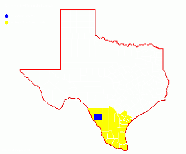
Region 7 Brushlands
Previous county: Dickens, Next: DonleyBordering counties - North: Zavala, Northeast: Frio, East: La Salle, South: Webb, West: Maverick
Top 100
County Big Years & Big Days
Dimmit County Top 10 Big Years
Hotspots
Guides and Resources
- Dell's map of Dimmit County for birding and exploring. It includes eBird Hotspots and additional potential locations, creek crossings and roads that may be productive.
Previous county: Dickens, Next: Donley
Bordering counties - North: Zavala, Northeast: Frio, East: La Salle, South: Webb, West: Maverick
