Difference between revisions of "Floyd County"
From Texas Century Club
Dell.Little (Talk | contribs) (→Region 1 Panhandle) |
Dell.Little (Talk | contribs) (→County Big Years & Big Days) |
||
| (15 intermediate revisions by 2 users not shown) | |||
| Line 1: | Line 1: | ||
==[[:Category:Region 1|Region 1 Panhandle]]== | ==[[:Category:Region 1|Region 1 Panhandle]]== | ||
| − | '''Previous county:''' ''[[Fisher County|Fisher]]'', '''Next:''' ''[[Foard County|Foard]]'' | + | '''Previous county:''' ''[[Fisher County|Fisher]]'', '''Next:''' ''[[Foard County|Foard]]'', '''All Counties:''' ''[[:Category:All Counties|Alphabetically]]''<br/ >'''Bordering counties''' - '''North:''' ''[[Briscoe County|Briscoe]]'', '''East:''' ''[[Motley County|Motley]]'', '''Southeast:''' ''[[Dickens County|Dickens]]'', '''South:''' ''[[Crosby County|Crosby]]'', '''Southwest:''' ''[[Lubbock County|Lubbock]]'', '''West:''' ''[[Hale County|Hale]]'', '''Northwest:''' ''[[Swisher County|Swisher]]''<br /> |
| + | |||
---- | ---- | ||
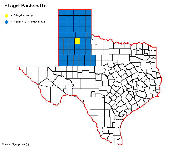
| − | [ | + | [[File:Floyd-Panhandle.gif|570px|right]] |
| − | + | ||
| + | == '''Century Clubbers''' == | ||
| + | {{#iDisplay:https://docs.google.com/spreadsheets/d/e/2PACX-1vS4AiLZvdbhBR3Vb4nGu_E_xLOYsCua-E0LPI8iibDO5km3l7-wt5F015jsM5fz6QwTIi5DdFg7DUGw/pubhtml?gid=0&single=true|250px}} | ||
| + | |||
| + | == '''[http://ebird.org/ebird/top100?locInfo.regionType=subnational2&locInfo.regionCode=US-TX-153&year=AAAA eBird Top 100]''' == | ||
| + | |||
| + | == '''County Big Years & Big Days'''== | ||
| + | <span style="font-size:120%">'''[[County_Big_Years|All County Top 10 Big <span style="font-size:130%">Years]]''' | ||
| + | |||
| + | {{#iDisplay:https://docs.google.com/spreadsheets/d/e/2PACX-1vQ28wLCvNtq08QGP2vpdZ1r_rgGpJDzgb2yJVX1pSku_zkhRdOu53GHELLWAIFSdZxYmeGzTPYfr5A8/pubhtml?gid=0&single=true|100%|400}} | ||
| + | |||
| + | <span style="font-size:120%">'''[[County_Big_Days|All County Top 10 Big <span style="font-size:130%">Days]]''' | ||
| + | |||
| + | {{#iDisplay:https://docs.google.com/spreadsheets/d/e/2PACX-1vStYXCWk7LVbWwqi6ZF__X3_5fHF5PkCYaVg71fq_losBy4efZNiP-4w_PymYWoWjdyxVheMr3OWgek/pubhtml?gid=0&single=true|100%|400}} | ||
---- | ---- | ||
| − | |||
| − | == | + | == '''[https://ebird.org/region/US-TX-153/hotspots?yr=all&m= eBird Hot Spots - (county name) County]''' == |
| − | + | ---- | |
| + | |||
| + | == Guides and Resources == | ||
| + | *<span style="font-size:120%">'''[https://birdinghotspots.org/region/US-TX-153 Birdinghotspots.org - Floyd County]''' | ||
| + | *'''[[County Listing Guide to Floyd County]] ''' Includes: | ||
| + | :* US62 AT WHITE RIVER | ||
| + | :* EAGLES HALL PARK | ||
| + | :* FLOYDADA | ||
| + | :* FLOYDADA CEMETERY | ||
| + | :* US62 PLAYAS | ||
| + | :* CR231 WETLANDS | ||
| + | :* DOUGHERTY AREA PLAYAS | ||
| + | :* LOCKNEY WWTP | ||
| + | :* WESTERN CATTLE FEEDERS AREA | ||
| + | :* FM378 COW POND | ||
| + | :* FM1065 LOS LINGOS CREEK CROSSING | ||
| + | |||
| + | *Dell's '''[https://drive.google.com/open?id=1mm-u-JXEydRenZWUpYe8GtSKNU_RbDHz&usp=sharing| map of Floyd County]''' including eBird Hotspots, locations and routing taken from Peter Keyel's '''[[County Listing Guide in the Southern High Plains]]''' and more. | ||
| + | |||
---- | ---- | ||
| − | '''Previous county:''' ''[[Fisher County|Fisher]]'', '''Next:''' ''[[Foard County|Foard]]'' | + | '''Previous county:''' ''[[Fisher County|Fisher]]'', '''Next:''' ''[[Foard County|Foard]]''<br/ >'''Bordering counties''' - '''North:''' ''[[Briscoe County|Briscoe]]'', '''East:''' ''[[Motley County|Motley]]'', '''Southeast:''' ''[[Dickens County|Dickens]]'', '''South:''' ''[[Crosby County|Crosby]]'', '''Southwest:''' ''[[Lubbock County|Lubbock]]'', '''West:''' ''[[Hale County|Hale]]'', '''Northwest:''' ''[[Swisher County|Swisher]]'' |
| − | [[ | + | [[Category:Region 1]] |
[[Category:All Counties]] | [[Category:All Counties]] | ||
Latest revision as of 20:14, 8 April 2025
Contents |
Region 1 Panhandle
Previous county: Fisher, Next: Foard, All Counties: Alphabetically
Bordering counties - North: Briscoe, East: Motley, Southeast: Dickens, South: Crosby, Southwest: Lubbock, West: Hale, Northwest: Swisher
Century Clubbers
eBird Top 100
County Big Years & Big Days
eBird Hot Spots - (county name) County
Guides and Resources
- US62 AT WHITE RIVER
- EAGLES HALL PARK
- FLOYDADA
- FLOYDADA CEMETERY
- US62 PLAYAS
- CR231 WETLANDS
- DOUGHERTY AREA PLAYAS
- LOCKNEY WWTP
- WESTERN CATTLE FEEDERS AREA
- FM378 COW POND
- FM1065 LOS LINGOS CREEK CROSSING
- Dell's map of Floyd County including eBird Hotspots, locations and routing taken from Peter Keyel's County Listing Guide in the Southern High Plains and more.
Previous county: Fisher, Next: Foard
Bordering counties - North: Briscoe, East: Motley, Southeast: Dickens, South: Crosby, Southwest: Lubbock, West: Hale, Northwest: Swisher
