Difference between revisions of "Potter County"
From Texas Century Club
m |
Dell.Little (Talk | contribs) |
||
| (14 intermediate revisions by 2 users not shown) | |||
| Line 1: | Line 1: | ||
| + | ==[[:Category:Region 1|Region 1 Panhandle]]== | ||
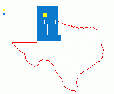
| + | '''Previous county:''' ''[[Polk County|Polk]]''; '''Next:''' ''[[Presidio County|Presidio]]''<br />'''Bordering counties''' - '''North:''' ''[[Moore County|Moore]]'', '''East:''' ''[[Carson County|Carson]]'', '''Southeast:''' ''[[Armstrong County|Armstrong]]'', '''South:''' ''[[Randall County|Randall]]'', '''Southwest:''' ''[[Deaf Smith County|Deaf Smith]]'', '''West:''' ''[[Oldham County|Oldham]]''<br />[[File:Potter-Panhandle.gif|380px|left]] | ||
| + | |||
| + | == Top 100 == | ||
{{#iDisplay:https://ebird.org/ebird/tx/top100?locInfo.regionType=subnational2&locInfo.regionCode=US-TX-375&year=AAAA}} | {{#iDisplay:https://ebird.org/ebird/tx/top100?locInfo.regionType=subnational2&locInfo.regionCode=US-TX-375&year=AAAA}} | ||
| + | ---- | ||
| + | |||
| + | == County Big Years & Big Days== | ||
| + | |||
| + | <span style="font-size:120%">'''[[County_Big_Years#Potter_County_-_Panhandle|Potter County Top 10 Big <span style="font-size:130%">Years]]''' | ||
| + | |||
| + | <span style="font-size:120%">'''[[County_Big_Days#Potter_County_-_Panhandle|Potter County Top 10 Big <span style="font-size:130%">Days]]''' | ||
| + | ---- | ||
| + | |||
| + | ==Hotspots== | ||
| + | {{#iDisplay:http://ebird.org/ebird/tx/subnational2/US-TX-375/hotspots?yr=all&m=}} | ||
| + | ---- | ||
| + | |||
| + | == Guides and Resources == | ||
| + | *'''[http://www.txpas.org/texas-bird-sites.html Texas Panhandle Audubon - Texas Bird Sites]''' Includes: | ||
| + | :* Lake Meredith National Recreation Area and Alibates Flint Quarries National Monument | ||
| + | :* Wildcat Bluff Nature Center | ||
| + | |||
| + | *'''[https://tpwd.texas.gov/huntwild/wildlife/wildlife-trails/php Great Texas Wildlife Trails - Panhandle Plains Region]''' at Texas Parks & Wildlife | ||
| + | :*'''[https://tpwd.texas.gov/huntwild/wildlife/wildlife-trails/php/canyon-loop Canyon Loop]''' Includes: | ||
| + | ::* Amarillo Medi-park | ||
| + | ::* Wildcat Bluff Nature Center | ||
| + | ::* Amarillo Thompson Municipal Park | ||
| + | :*'''[https://tpwd.texas.gov/huntwild/wildlife/wildlife-trails/php/rita-blanca-loop Rita Blanca Loop]''' Includes: | ||
| + | ::* Alibates Flint Quarry National Monument | ||
| + | ::* Lake Meredith National Recreation Area | ||
| + | ---- | ||
| + | '''Previous county:''' ''[[Polk County|Polk]]''; '''Next:''' ''[[Presidio County|Presidio]]''<br />'''Bordering counties''' - '''North:''' ''[[Moore County|Moore]]'', '''East:''' ''[[Carson County|Carson]]'', '''Southeast:''' ''[[Armstrong County|Armstrong]]'', '''South:''' ''[[Randall County|Randall]]'', '''Southwest:''' ''[[Deaf Smith County|Deaf Smith]]'', '''West:''' ''[[Oldham County|Oldham]]'' | ||
[[category:Region 1]] | [[category:Region 1]] | ||
[[Category:All Counties]] | [[Category:All Counties]] | ||
Latest revision as of 17:17, 14 December 2020
Contents |
Region 1 Panhandle
Previous county: Polk; Next: PresidioBordering counties - North: Moore, East: Carson, Southeast: Armstrong, South: Randall, Southwest: Deaf Smith, West: Oldham
Top 100
County Big Years & Big Days
Potter County Top 10 Big Years
Hotspots
Guides and Resources
- Lake Meredith National Recreation Area and Alibates Flint Quarries National Monument
- Wildcat Bluff Nature Center
- Great Texas Wildlife Trails - Panhandle Plains Region at Texas Parks & Wildlife
- Canyon Loop Includes:
- Amarillo Medi-park
- Wildcat Bluff Nature Center
- Amarillo Thompson Municipal Park
- Rita Blanca Loop Includes:
- Alibates Flint Quarry National Monument
- Lake Meredith National Recreation Area
Previous county: Polk; Next: Presidio
Bordering counties - North: Moore, East: Carson, Southeast: Armstrong, South: Randall, Southwest: Deaf Smith, West: Oldham
