Difference between revisions of "Lamb County"
From Texas Century Club
Dell.Little (Talk | contribs) |
Dell.Little (Talk | contribs) |
||
| (10 intermediate revisions by one user not shown) | |||
| Line 1: | Line 1: | ||
==[[:Category:Region 1|Region 1 Panhandle]]== | ==[[:Category:Region 1|Region 1 Panhandle]]== | ||
| − | '''Previous county:''' ''[[Lamar County|Lamar]]''; '''Next:''' ''[[Lampasas County|Lampasas]]'' | + | '''Previous county:''' ''[[Lamar County|Lamar]]''; '''Next:''' ''[[Lampasas County|Lampasas]]''<br/ >'''Bordering counties''' - '''North:''' ''[[Castro County|Castro]]'', '''East:''' ''[[Hale County|Hale]]'', '''Southeast:''' ''[[Lubbock County|Lubbock]]'', '''South:''' ''[[Hockley County|Hockley]]'', '''Southwest:''' ''[[Cochran County|Cochran]]'', '''West:''' ''[[Bailey County|Bailey]]'', '''Northwest:''' ''[[Parmer County|Parmer]]''<br />[[File:Lamb-Panhandle.gif|380px|left]] |
| + | |||
| + | == Top 100 == | ||
| + | {{#iDisplay:http://ebird.org/ebird/tx/top100?locInfo.regionType=subnational2&locInfo.regionCode=US-TX-279&year=AAAA}} | ||
---- | ---- | ||
| − | '''[ [ | + | |
| − | < | + | == County Big Years & Big Days== |
| + | |||
| + | <span style="font-size:120%">'''[[County_Big_Years#Lamb_County_-_Panhandle|Lamb County Top 10 Big <span style="font-size:130%">Years]]''' | ||
| + | |||
| + | <span style="font-size:120%">'''[[County_Big_Days#Lamb_County_-_Panhandle|Lamb County Top 10 Big <span style="font-size:130%">Days]]''' | ||
---- | ---- | ||
| − | |||
==Hotspots== | ==Hotspots== | ||
{{#iDisplay:https://ebird.org/region/US-TX-279/hotspots?yr=all&m=}} | {{#iDisplay:https://ebird.org/region/US-TX-279/hotspots?yr=all&m=}} | ||
---- | ---- | ||
| − | '''Previous county:''' ''[[Lamar County|Lamar]]''; '''Next:''' ''[[Lampasas County|Lampasas]]'' | + | |
| + | == Guides and Resources == | ||
| + | *'''[[County Listing Guide to Lamb County]]''' Includes: | ||
| + | :* LITTLEFIELD WWTP | ||
| + | :* LITTLEFIELD CR310 PLAYA | ||
| + | :* MAGIC PLAYA HWY385 x CR334 | ||
| + | :* LAGUNA PARK | ||
| + | :* LITTLEFIELD CEMETERY | ||
| + | :* LAMB CO CR292 | ||
| + | :* FM1055 x FM2901 PLAYA | ||
| + | :* EARTH CEMETERY | ||
| + | :* SPRINGLAKE PLAYAS | ||
| + | :* OLTON PLAYA | ||
| + | :* CATTLEMAN’S FEEDLOT | ||
| + | |||
| + | *'''[https://tpwd.texas.gov/huntwild/wildlife/wildlife-trails/php/muleshoe-loop Great Texas Wildlife Trails - Panhandle Plains Region: Muleshoe Loop]''' at Texas Parks & Wildlife | ||
| + | :Includes: | ||
| + | :* Muleshoe NWR | ||
| + | :* North Driving Route between FM 298 and FM 1760 | ||
| + | |||
| + | *Dell's '''[https://drive.google.com/open?id=1YQVUKWaw-uMbXXVZVWNNHVhBsP-MhFUN&usp=sharing| map of Lamb County]'''including eBird Hotspots, locations and routing taken from Peter Keyel's '''[[County Listing Guide in the Southern High Plains]]''' | ||
| + | |||
| + | ---- | ||
| + | '''Previous county:''' ''[[Lamar County|Lamar]]''; '''Next:''' ''[[Lampasas County|Lampasas]]''<br/ >'''Bordering counties''' - '''North:''' ''[[Castro County|Castro]]'', '''East:''' ''[[Hale County|Hale]]'', '''Southeast:''' ''[[Lubbock County|Lubbock]]'', '''South:''' ''[[Hockley County|Hockley]]'', '''Southwest:''' ''[[Cochran County|Cochran]]'', '''West:''' ''[[Bailey County|Bailey]]'', '''Northwest:''' ''[[Parmer County|Parmer]]'' | ||
[[Category:Region 1]] | [[Category:Region 1]] | ||
[[Category:All Counties]] | [[Category:All Counties]] | ||
Latest revision as of 00:38, 14 December 2020
Contents |
Region 1 Panhandle
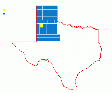
Previous county: Lamar; Next: LampasasBordering counties - North: Castro, East: Hale, Southeast: Lubbock, South: Hockley, Southwest: Cochran, West: Bailey, Northwest: Parmer
Top 100
County Big Years & Big Days
Hotspots
Guides and Resources
- County Listing Guide to Lamb County Includes:
- LITTLEFIELD WWTP
- LITTLEFIELD CR310 PLAYA
- MAGIC PLAYA HWY385 x CR334
- LAGUNA PARK
- LITTLEFIELD CEMETERY
- LAMB CO CR292
- FM1055 x FM2901 PLAYA
- EARTH CEMETERY
- SPRINGLAKE PLAYAS
- OLTON PLAYA
- CATTLEMAN’S FEEDLOT
- Great Texas Wildlife Trails - Panhandle Plains Region: Muleshoe Loop at Texas Parks & Wildlife
- Includes:
- Muleshoe NWR
- North Driving Route between FM 298 and FM 1760
- Dell's map of Lamb Countyincluding eBird Hotspots, locations and routing taken from Peter Keyel's County Listing Guide in the Southern High Plains
Previous county: Lamar; Next: Lampasas
Bordering counties - North: Castro, East: Hale, Southeast: Lubbock, South: Hockley, Southwest: Cochran, West: Bailey, Northwest: Parmer
