Difference between revisions of "Mason County"
From Texas Century Club
Dell.Little (Talk | contribs) |
Dell.Little (Talk | contribs) |
||
| Line 4: | Line 4: | ||
== Top 100 == | == Top 100 == | ||
{{#iDisplay:http://ebird.org/ebird/tx/top100?locInfo.regionType=subnational2&locInfo.regionCode=US-TX-319&year=AAAA}} | {{#iDisplay:http://ebird.org/ebird/tx/top100?locInfo.regionType=subnational2&locInfo.regionCode=US-TX-319&year=AAAA}} | ||
| + | ---- | ||
| + | |||
| + | == County Big Years & Big Days== | ||
| + | |||
| + | <span style="font-size:120%">'''[[County_Big_Years#Mason_County_-_Edwards_Plateau|Mason County Top 10 Big <span style="font-size:130%">Years]]''' | ||
| + | |||
| + | <span style="font-size:120%">'''[[County_Big_Days#Mason_County_-_Edwards_Plateau|Mason County Top 10 Big <span style="font-size:130%">Days]]''' | ||
---- | ---- | ||
| Line 18: | Line 25: | ||
*Dell's map of [https://drive.google.com/open?id=10FGuyJFJ3B4_rHu0SwqIJmY8Vh4&usp=sharing| Mason County] for birding and exploring. It includes eBird Hotspots and additional potential locations, creek crossings and roads that may be productive. | *Dell's map of [https://drive.google.com/open?id=10FGuyJFJ3B4_rHu0SwqIJmY8Vh4&usp=sharing| Mason County] for birding and exploring. It includes eBird Hotspots and additional potential locations, creek crossings and roads that may be productive. | ||
| − | |||
| − | |||
| − | |||
| − | |||
| − | |||
| − | |||
| − | |||
| − | |||
| − | |||
| − | |||
| − | |||
| − | |||
| − | |||
| − | |||
| − | |||
| − | |||
| − | |||
| − | |||
| − | |||
| − | |||
| − | |||
| − | |||
| − | |||
| − | |||
| − | |||
---- | ---- | ||
'''Previous county:''' ''[[Martin County|Martin]]'', '''Next:''' ''[[Matagorda County|Matagorda]]''<br/ >'''Bordering counties''' - '''North:''' ''[[McCulloch County|Mcculloch]]'', '''Northeast:''' ''[[San Saba County| San Saba]]'', '''East:''' ''[[Llano County|Llano]]'', '''Southeast''' ''[[Gillespie County|Gillespie]]'', '''Southwest:''' ''[[Kimble County|Kimble]]'', '''West:''' ''[[Menard County|Menard]]'' | '''Previous county:''' ''[[Martin County|Martin]]'', '''Next:''' ''[[Matagorda County|Matagorda]]''<br/ >'''Bordering counties''' - '''North:''' ''[[McCulloch County|Mcculloch]]'', '''Northeast:''' ''[[San Saba County| San Saba]]'', '''East:''' ''[[Llano County|Llano]]'', '''Southeast''' ''[[Gillespie County|Gillespie]]'', '''Southwest:''' ''[[Kimble County|Kimble]]'', '''West:''' ''[[Menard County|Menard]]'' | ||
[[category:Region 5]] | [[category:Region 5]] | ||
[[category:All Counties]] | [[category:All Counties]] | ||
Revision as of 02:58, 14 December 2020
Contents |
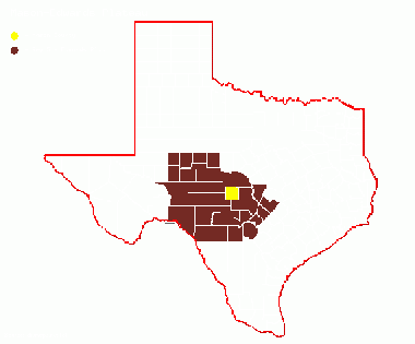
Region 5 Edwards Plateau
Previous county: Martin, Next: MatagordaBordering counties - North: Mcculloch, Northeast: San Saba, East: Llano, Southeast Gillespie, Southwest: Kimble, West: Menard
Top 100
County Big Years & Big Days
Hotspots
Guides and Resources
- Great Texas wildlife Trails - Heart of Texas West Region: Topaz Loop at Texas Parks & Wildlife
- Includes:
- Homer Martin Ranch
- Fort Mason City Park
- Eckert James River Bat Cave Preserve
- Dell's map of Mason County for birding and exploring. It includes eBird Hotspots and additional potential locations, creek crossings and roads that may be productive.
Previous county: Martin, Next: Matagorda
Bordering counties - North: Mcculloch, Northeast: San Saba, East: Llano, Southeast Gillespie, Southwest: Kimble, West: Menard
