Difference between revisions of "Bandera County"
From Texas Century Club
Dell.Little (Talk | contribs) |
Dell.Little (Talk | contribs) |
||
| Line 13: | Line 13: | ||
*Dell's map of [https://drive.google.com/open?id=1MCP3kUAKd79zkR10AhaxR9nCJ7k&usp=sharing| Bandera County] for birding and exploring. It includes eBird Hotspots and additional potential locations, creek crossings and roads that may be productive. | *Dell's map of [https://drive.google.com/open?id=1MCP3kUAKd79zkR10AhaxR9nCJ7k&usp=sharing| Bandera County] for birding and exploring. It includes eBird Hotspots and additional potential locations, creek crossings and roads that may be productive. | ||
---- | ---- | ||
| − | + | == Top 10 Years == | |
| − | == | + | |
{| border="1" style="text-align: center; border-collapse:collapse" | {| border="1" style="text-align: center; border-collapse:collapse" | ||
!Rnk!!Leaders!!# of Species!!Year | !Rnk!!Leaders!!# of Species!!Year | ||
Revision as of 19:05, 14 June 2019
Contents |
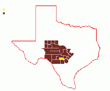
Region 5 Edwards Plateau
Previous county: Bailey, Next: BastropBordering counties: North: Kerr, Northeast: Kendall, East: Bexar, South: Medina, Southwest: Uvalde, West: Real
Top 100
Hotspots
Guides and Resources
- Dell's map of Bandera County for birding and exploring. It includes eBird Hotspots and additional potential locations, creek crossings and roads that may be productive.
Top 10 Years
| Rnk | Leaders | # of Species | Year |
|---|---|---|---|
| 1 | Martin Hagne | 194 | 2015 |
| 2 | Richard Redmond | 182 | 2016 |
| 3 | Martin Hagne | 178 | 2016 |
| 3 | Martin Hagne | 178 | 2014 |
| 5 | Richard Redmond | 167 | 2014 |
| 6 | Richard Redmond | 165 | 2015 |
| 6 | Ronald Hood | 165 | 2011 |
| 8 | Richard Redmond | 154 | 2018 |
| 9 | Ronald Hood | 145 | 2013 |
| 10 | Ronald Hood | 144 | 2014 |
Previous county: Bailey, Next: Bastrop
Bordering counties: North: Kerr, Northeast: Kendall, East: Bexar, South: Medina, Southwest: Uvalde, West: Real
